Can anyone point me towards a source that includes a map of autobahn development during the 1930s?
I would particularly like one showing annual completions during the 1930s.
Many thanks,
Sid.
Map of annual autobahn development in 1930s?
-
sid guttridge
- on "time out"
- Posts: 8055
- Joined: Thu Oct 10, 2002 4:54 am
-
Jason Pipes

- Patron
- Posts: 1800
- Joined: Wed Sep 25, 2002 4:06 pm
- Location: CA & WI
-
Arne

- Contributor
- Posts: 337
- Joined: Thu Jun 19, 2003 1:15 am
- Location: Heart of the Ruhr Valley
- Contact:
Take a look here:
http://www.autobahn-online.de/geschichte.html
Sorry, no maps. The first line in the main frame of the page (Die ersten freigegebenen Teilstücke) is a list with dates when the road connection was opened.
http://www.autobahn-online.de/geschichte.html
Sorry, no maps. The first line in the main frame of the page (Die ersten freigegebenen Teilstücke) is a list with dates when the road connection was opened.
-
sid guttridge
- on "time out"
- Posts: 8055
- Joined: Thu Oct 10, 2002 4:54 am
Hi Jason and Arne,
I also collect motor club (and virtually any other) maps, although I have none of Germany in the 1930s.
I have had a look at the site Arne suggested and it contains exactly the sort of information I am after. I have taken annual print-outs for autobahn construction in the years 1935-43 and simply have to superimpose their information on a map of the autobahn system. Excellent! I recommend this site to anyone interested in the minutiae of autobahn construction.
Many thanks guys.
Cheers,
Sid.

Take a look here:
http://www.autobahn-online.de/geschichte.html
>Sorry, no maps. The first line in the main frame of the page (Die ersten freigegebenen Teilstücke) is a list with dates when the road connection was opened.<
Not correct, maps are avalible at the VERY bottom of this site.
Some pics:
http://www.autobahn-online.de/images/gallerie.html
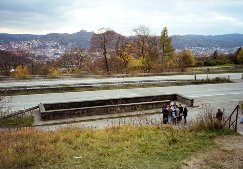
Does that look like a parade watch area to you? (A4 at Eisenach)
http://www.autobahn-online.de/images/eisenach.jpg
http://www.autobahn-online.de/geschichte.html
>Sorry, no maps. The first line in the main frame of the page (Die ersten freigegebenen Teilstücke) is a list with dates when the road connection was opened.<
Not correct, maps are avalible at the VERY bottom of this site.
Some pics:
http://www.autobahn-online.de/images/gallerie.html
Does that look like a parade watch area to you? (A4 at Eisenach)
http://www.autobahn-online.de/images/eisenach.jpg
-
sid guttridge
- on "time out"
- Posts: 8055
- Joined: Thu Oct 10, 2002 4:54 am
-
sid guttridge
- on "time out"
- Posts: 8055
- Joined: Thu Oct 10, 2002 4:54 am
-
Alex Dekker

- Associate
- Posts: 636
- Joined: Sat Mar 01, 2003 12:37 pm
- Location: Alkmaar,The Netherlands
- Contact: