
As some of you know, I have been working on a 3D model of the city of Stalingrad as it appeared in the fall of 1942. With the aid of numerous museums, archives, and private collectors from Russia, Germany, and the USA this project is all coming together.
This model is created with 2-foot contour lines from maps of Stalingrad from the 1930’s and 1940’s and I have even fashioned the Volga river bottom from navigational charts I located from same period.
There are 2,386 buildings fashioned in this model and this area reflects about 10% of the overall 3D project. All the modeling and colorization was created with AutoCAD, 3D Studio Max and Adobe Photoshop.
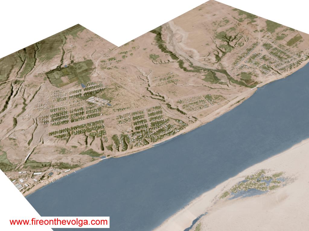
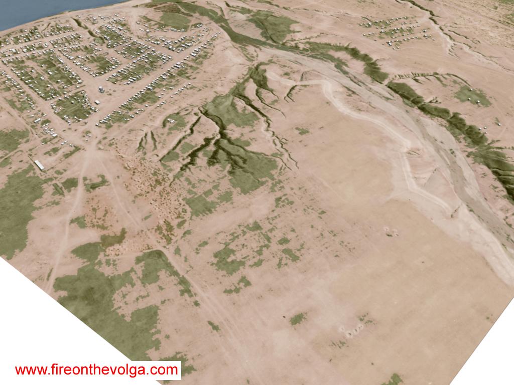
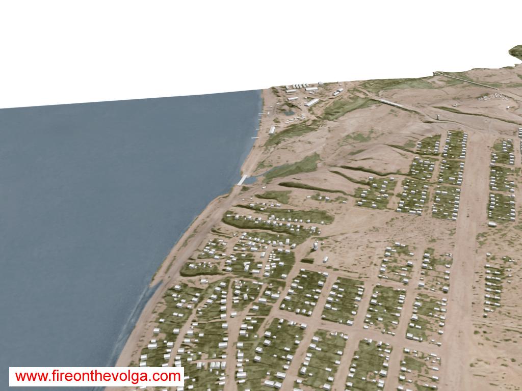
From left to right: Northern area of the Dzerhezinsky Tractor Factory, village of Spartanovka and the village of Rynok.

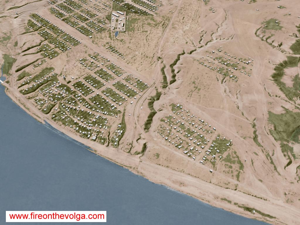
The village of Rynok.
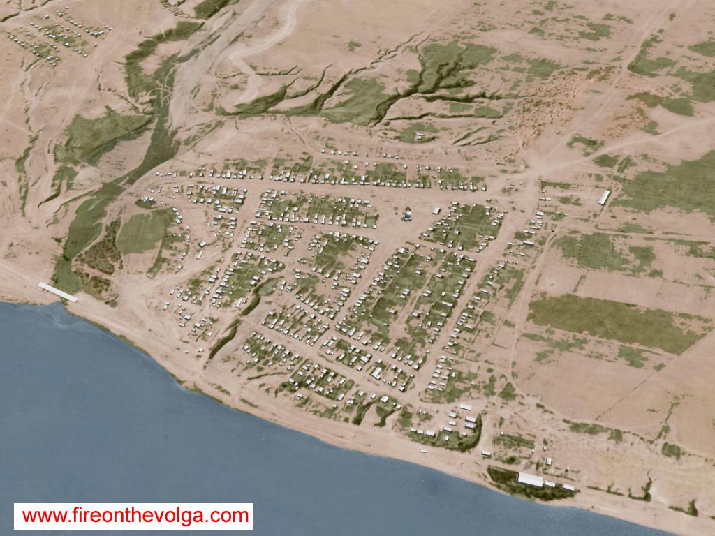
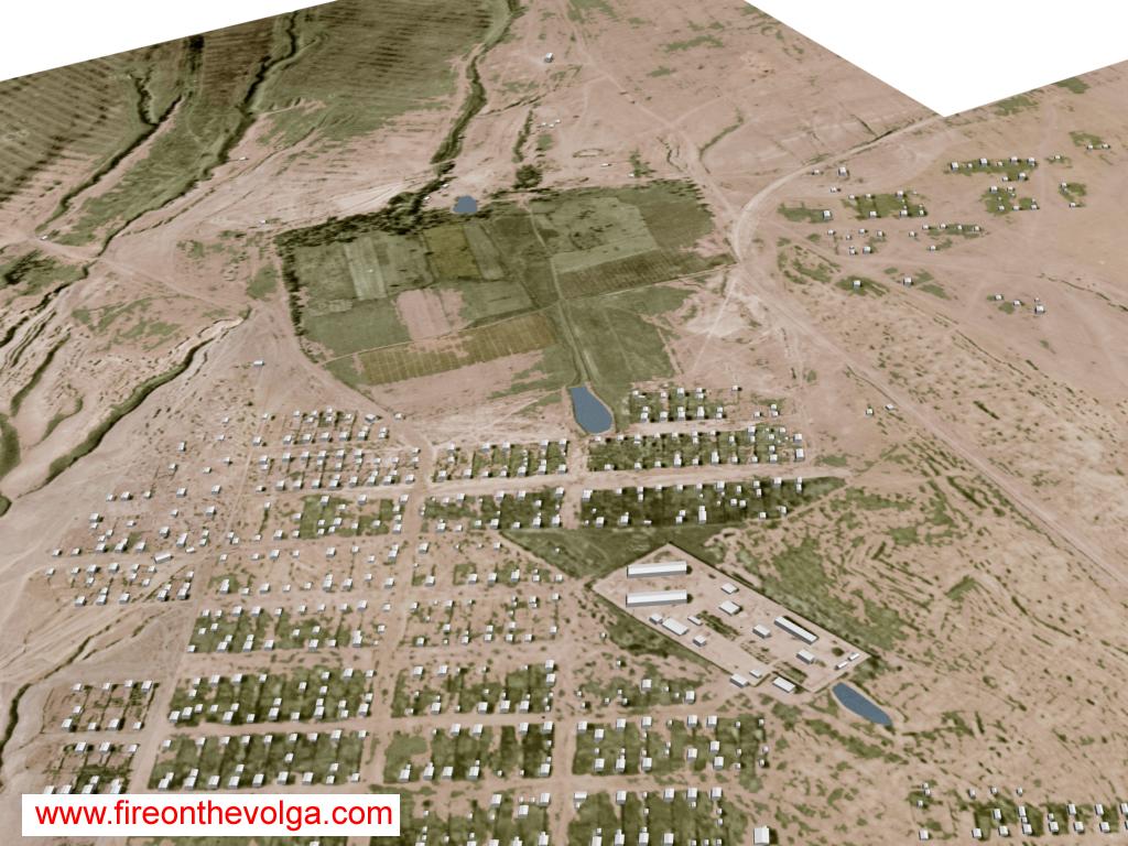
The village of Spartanovka.
From left to right: Northern area of the Dzerhezinsky Tractor Factory, village of Spartanovka and the village of Rynok
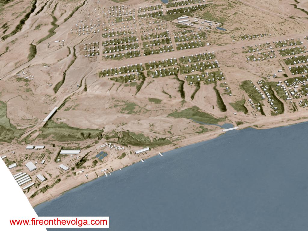
From left to right: Northern area of the Dzerhezinsky Tractor Factory and the village of Spartanovka.
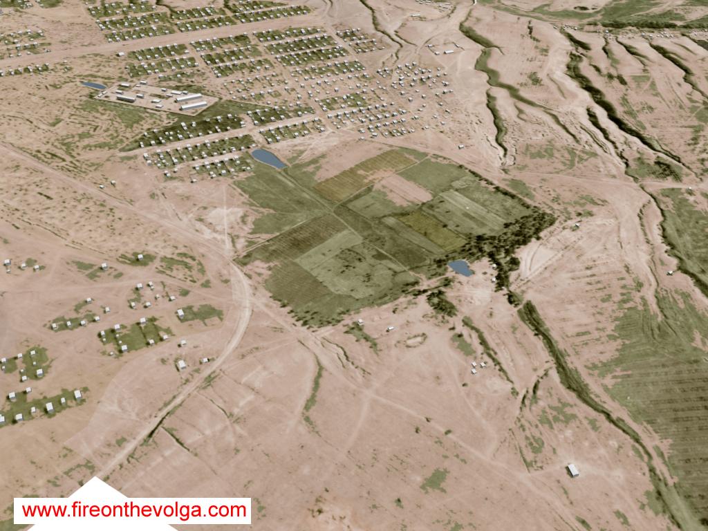
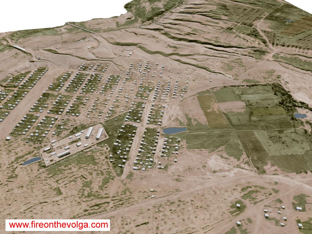
Center top to lower right: Spartanovka cemetery and prison.
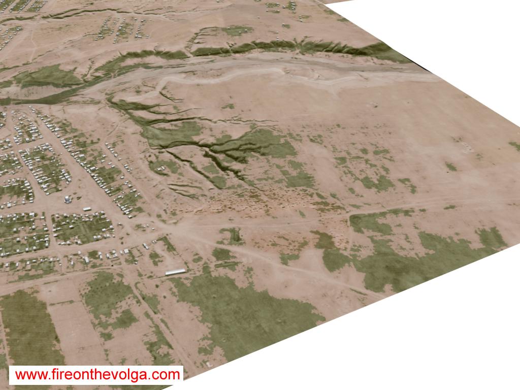
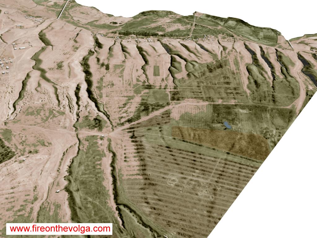
From left to right: Mokraya Mechetka (River ravine) and northern area of the Dzerhezinsky Tractor Factory.
From lower left to right: Mokraya Mechetka (River ravine) and northern area of the Dzerhezinsky Tractor Factory.
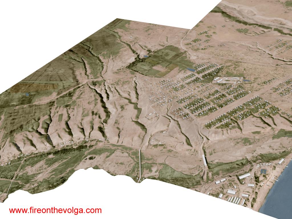
From left to right: The village of Rynok, the village of Spartanovka and the northern area of the Dzerhezinsky Tractor factory.
Center: Spartanovka cemetery.
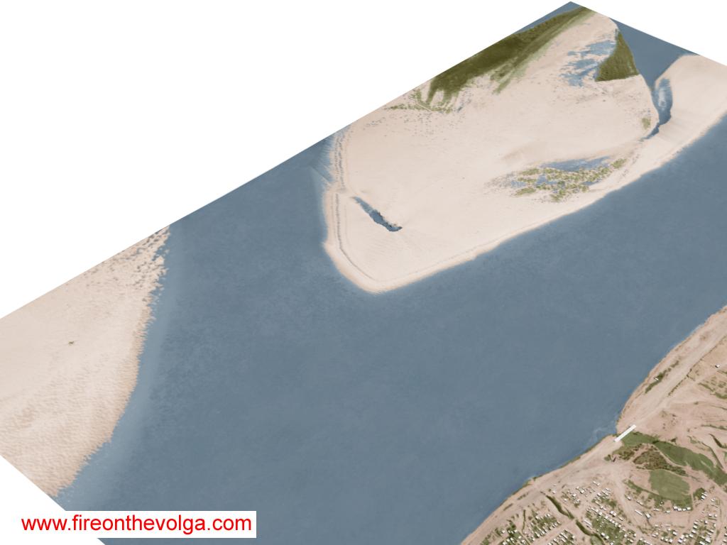
Center-left to Top: Soviet horseshoe defensive mound west of Rynok village, nickname by German forces as the “Big Mushroom” and Skuchaya Mechetka (River ravine).
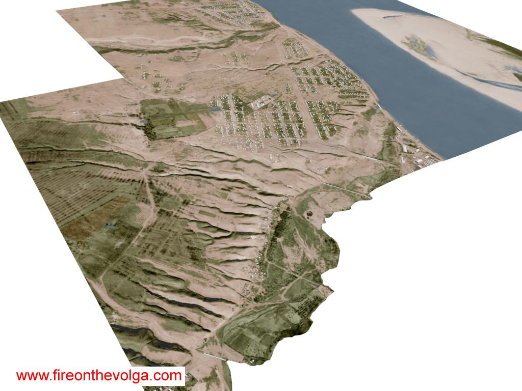
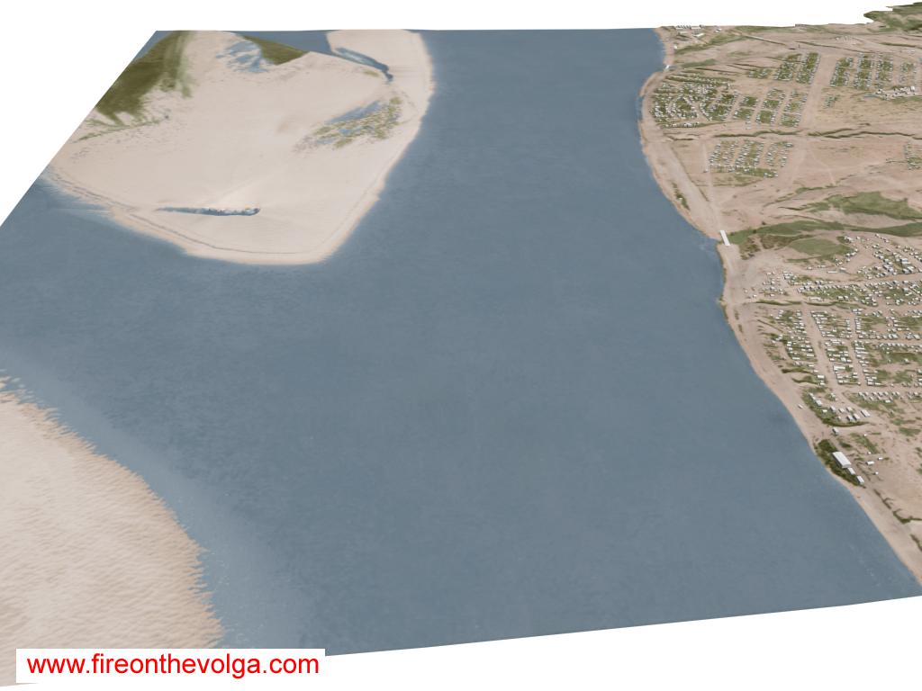
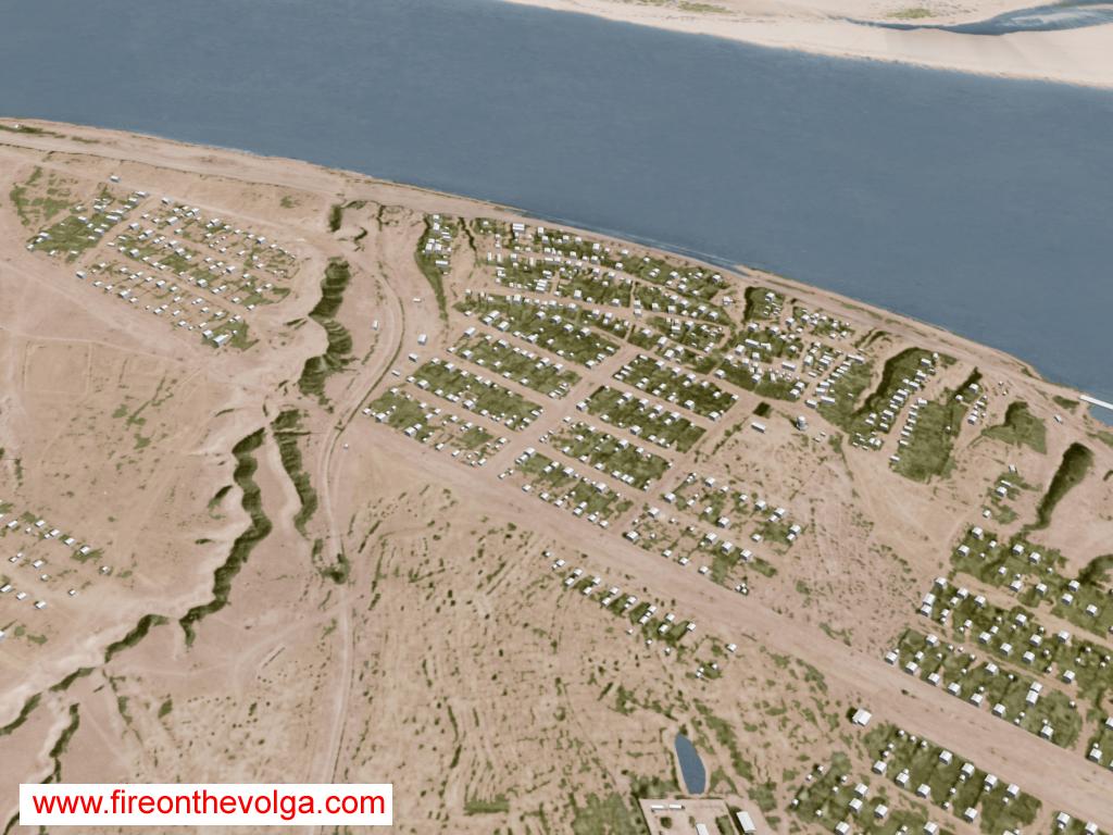
From lower left to upper right: Spornyi Island, Volga River, and Zaitsevski Island.
Volga River looking south.
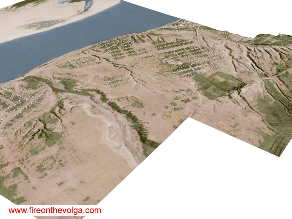
Spartanovka village looking south.
From left to right: Spartanovka prison and cemetery.
Center: Soviet horseshoe defensive mound “Big Mushroom.”
Lower left: Soviet defensive mound west of Spartanovka cemetery, nickname by German forces as the “Little Mushroom.”
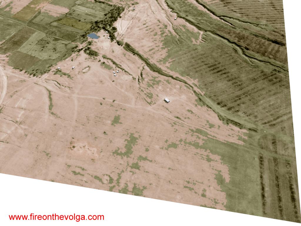
Top Mokraya Mechetka (River ravine) looking south.
Center-left to top: Spartanovka prison, the village of Spartanovka and northern area of the Dzerhezinsky Tractor Factory.
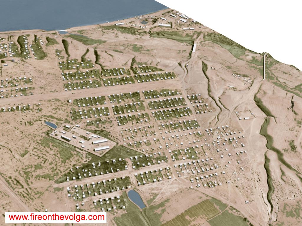
The village of Spartanovka. (Looking northeasterly)
Russ

http://www.fireonthevolga.com
 For the last 25+ years, 95% of my free time has been directed to researching and studying the Stalingrad battle.